Promoting the Waterways
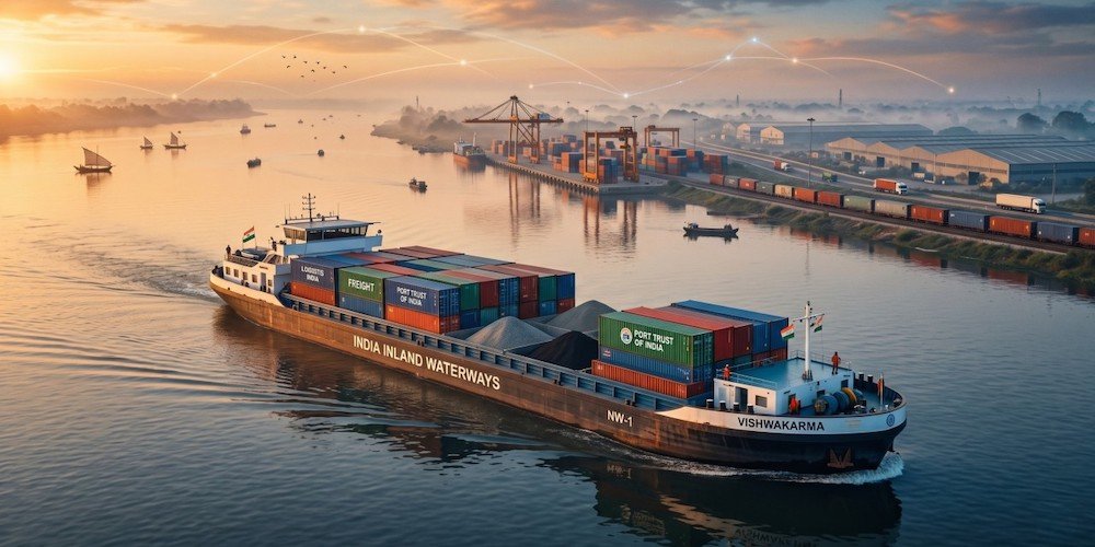
India is building a safer and smarter inland navigation ecosystem as waterway traffic expands. Hydrographic surveys and fairway maintenance keep channels navigable, while India’s first riverine lighthouses on the Brahmaputra add long-range support for 24×7 navigation. Digital platforms provide real-time depth, route and weather information. Together, these interventions are strengthening navigation safety, improving predictability and supporting the growing movement of cargo across India’s waterways
India’s economic future is deeply tied to its water. As the nation targets rapid GDP growth and sustainable infrastructure, revitalizing its Inland Waterways Transport (IWT) network stands out as a critical economic and environmental imperative. Historically, India’s massive river systems served as the primary highways for trade and cultural exchange. However, the modern era saw a heavy tilt toward rail and road, leaving waterways underutilized. Today, navigating toward a better-networked waterways system offers a transformative path to decongesting land routes, slashing logistics costs, and reducing the nation’s carbon footprint.
The country has 111 National Waterways (NW) to promote shipping and navigation. The total length of these waterways is 20,187 km, spread across 23 States and 4 Union Territories. Of these, 32 National Waterways are currently operational. The growing economic value of waterways is reflected in their rapidly increasing freight movement. Cargo movement on inland waterways rose from 29 million metric tonnes (MMT) in 2014–15 to 218 MMT in 2025–26. This represents a Compound Annual Growth Rate (CAGR) of 20.13%. The growth has already surpassed the target of 200 MMT set under Maritime India Vision 2030. Inland waterways are therefore moving from potential to performance.
But still, much needs to be done. All told, India’s logistics sector currently relies disproportionately on roads and railways. Waterways account for less than 1 percent of cargo movement, despite the fact that moving a ton of cargo by water costs roughly a fraction of road transport and uses significantly less fuel per ton-kilometer. Developing this network is no longer just an alternative; it is an economic necessity.
Strategic Framework and Policy Push
The blueprint for a better-networked waterways system shifted into high gear with the enactment of the National Waterways Act, which declared 111 rivers, creeks, and canals as National Waterways (NWs). Among these, the primary focus has been on developing key operational corridors:
• National Waterway 1 (NW-1): The Ganga-Bhagirathi-Hooghly river system, stretching from Prayagraj to Haldia, serves as the backbone of northern freight movement.
• National Waterway 2 (NW-2): The Brahmaputra River, connecting Northeast India with mainstream trade channels.
• National Waterway 3 (NW-3): The West Coast Canal in Kerala, pioneering industrial and urban cargo integration.

To fuel this expansion, initiatives like the Sagarmala Programme and the Jal Marg Vikas Project (JMVP) have funneled investment into modern infrastructure. These programmes focus on creating multi-modal terminals, introducing night navigation technologies, and constructing massive navigational locks to ensure year-round vessel movement.
Overcoming Key Challenges
Navigating toward a fully integrated network requires overcoming significant geographical and structural hurdles.
1. Siltation and Depth Maintenance: Rivers like the Ganga and Brahmaputra carry massive sediment loads. Continuous, eco-friendly dredging is vital to maintaining a Least Available Depth (LAD) of 2.5 to 3 meters for large commercial barges.
2. Seasonal Flow Fluctuations: Indian rivers are heavily dependent on monsoons. During dry summer months, water levels drop drastically, disrupting schedule reliability.
3. Last-Mile Connectivity: Waterways cannot operate in isolation. A barge carrying coal or steel is only as efficient as the rail line or highway connecting the river terminal to the final inland destination.
Addressing these issues demands smart engineering, such as deploying modern river information systems (RIS) and designing shallow-draft vessels specifically tailored for Indian river conditions.
Environmental and Regional Benefits
The shift toward water-based logistics aligns perfectly with India’s climate commitments. Water transport emits significantly less carbon dioxide compared to trucking, providing an immediate boost to the country’s net-zero targets.
Furthermore, a well-networked waterways system acts as an engine for regional equity. The development of NW-2 (Brahmaputra) and NW-16 (Barak River) provides the landlocked Northeast region with direct access to sea routes via Kolkata and Bangladesh ports. This integration bypasses the congested Siliguri Corridor, drastically cutting transit times and opening up new markets for agricultural and industrial goods from the Northeast.
The Path Forward
To unlock the full potential of its rivers, India must focus on the seamless execution of multi-modal logistics parks. River terminals must connect effortlessly with nearby rail freight corridors and expressways. Additionally, encouraging private sector participation through public-private partnerships (PPPs) will bring the necessary capital and operational expertise to manage terminals and vessel fleets.
Navigating through a better-networked waterways system is not merely about clearing river channels; it is about rewriting India’s supply chain strategy. By transforming its rivers into vibrant trade corridors, India can create a sustainable, cost-effective, and resilient logistics network capable of powering its economic ambitions for decades to come.